Shelby County, AL - Line Drawing
Here's the line art for a map of Shelby County, Alabama. Click the images to enlarge.
 I inked it digitally in Manga Studio. These colored lines will make it easier for me to do self-lined roads and such.


Glencoe Crossing, IL - Line Drawing
Here's my map of Glencoe Crossing, Illinois, still in progress. Now it's inked:
Glencoe Crossing, IL - Pencil Drawing
Here's an upcoming map in the pencil phase. Click the image to see it in closer detail:
Jeff State - Line Drawing
Here's the line art for a new map I'm working on - Jefferson State Community College. Their main campus is in Birmingham, Alabama - or more like Tarrant, I guess - and they have several satellites around the outlying towns, as you can see. Click the image to get a more detailed look: I'll put a big Jeff State logo in the upper left. The box on the right will be the Campus Index. The large part of the map will be labeled "Jefferson Campus." The sections across the bottom will be labeled, from left to right, "St. Clair Moody Site," "St. Clair Pell City Site," "Chilton-Clanton Site," and "Shelby-Hoover Campus." Now down to the business of color.
Greenville, AL
At long last, it's done! Apologies to anyone who had to wait on this. I had to stop in the middle and do a whole 'nother map. Now without further ado, I'm happy to present Greenville, Alabama:
 Click the image for a larger view. I think this map is one of my very best (along with Monteagle, Tennessee). It's got painterly colors, appealingly distorted buildings, and townsfolk. This is the first time I've gotten to put factoids on a map, which I think are a really nice feature. This is also the first time I've tried to be more specific about my tree types. Usually I just draw some generic deciduous trees, maybe peppering the map with a few generic evergreens. I do that by making them Christmas tree-shaped. This time, I made an effort to draw the actual trees that would be found in the area - oaks, loblolly pines, shortleaf pines, and a couple of hickories. I don't really know my trees, so I'm not sure how well I did.
Here are some close-ups. If you want a better view, just click below:


Greenville, AL In Progress
Here's an update on Greenville, Alabama. The color is done, but I still have to add the street names, highway numbers, business logos, and stuff like that. It'll say "Greenville" in that big, empty area on the left:

Click the image to see it closer up. I'll post it again in greater detail when it's completely finished.
Greenville, AL Line Drawing
Here's the line art for Greenville, Alabama: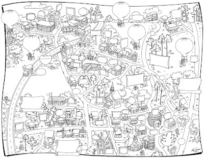 This is going to be a fun one. The buildings have cute proportions, and there are goofy characters in the balloons and roaming the area. And I'm going to color it with an oily look, sort of like in this Thank-You Card I painted.Hopefully I'll have the color and signage done on this map in a week or two.
Gardendale, AL Line Drawing
I just finished the line art on Gardendale, Alabama. This also includes some stuff in Warrior, Morris, Mount Olive, and Fultondale.
I inked it in a skritchy, croquil sort of style, and I plan to paint it with a watercolory look. I'm hoping that'll make it seem like a cool, old, pirate map or something . . . except for the fact that it'll be covered with ads and logos.
Here it is so far:
Comics Country
This is an entirely different kind of map. I drew this for the Comics Journal, to advertise cool comic shops around the nation. It's a two-page spread, so the composition is a bit odd. Imagine that the spine of the magazine (or the "gutter") splits the picture down the middle.
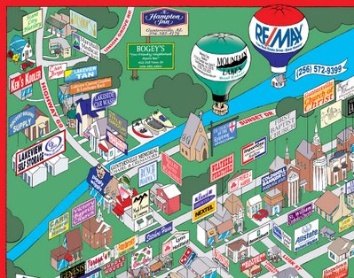
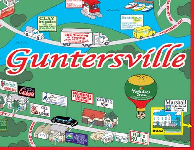
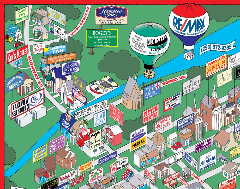
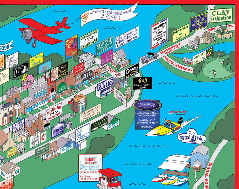
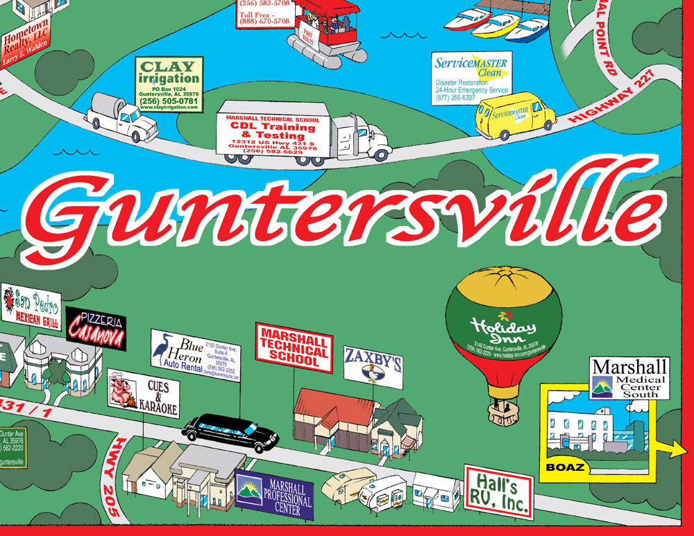
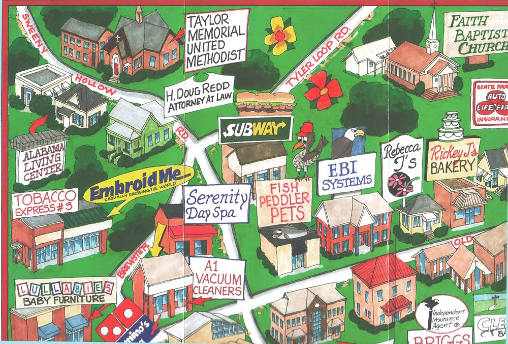
Guntersville, AL
Here's Guntersville, Alabama: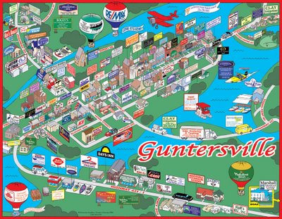
As I said, this one's chock full with 120 things I had to put in, and lakes all over the place. There's a lot more stuff in it than in any of the other maps I've done so far. I tried to make it a little snazzier by using all real logos and type this time, instead of hand-lettering.
Click to see it in close-up, or if you want to see it closer still, you can click one of these closer up close-ups:

 When I got this assignment, they wanted me to use colors more like the ones Jim Baird paints. He's another artist my boss employs, out of North Carolina. Here's part of his map of Clay, Alabama:
 I did use his colors for the grass and trees, but they don't look the same, here on the web. I think when they're printed out, they'll at least be similar. I also ripped off his use of red borders, red street names, and the big city name in red with a white outline. And another thing he does - instead of filling up the place with trees all over, he just puts in some occasional shrub-like foliage. I tried my own version of that, but I'm not too crazy about it. It sure saves time, though.
Guntersville, AL Line Drawing
This map is packed full with more than 100 clients, plus lakes all over the place:
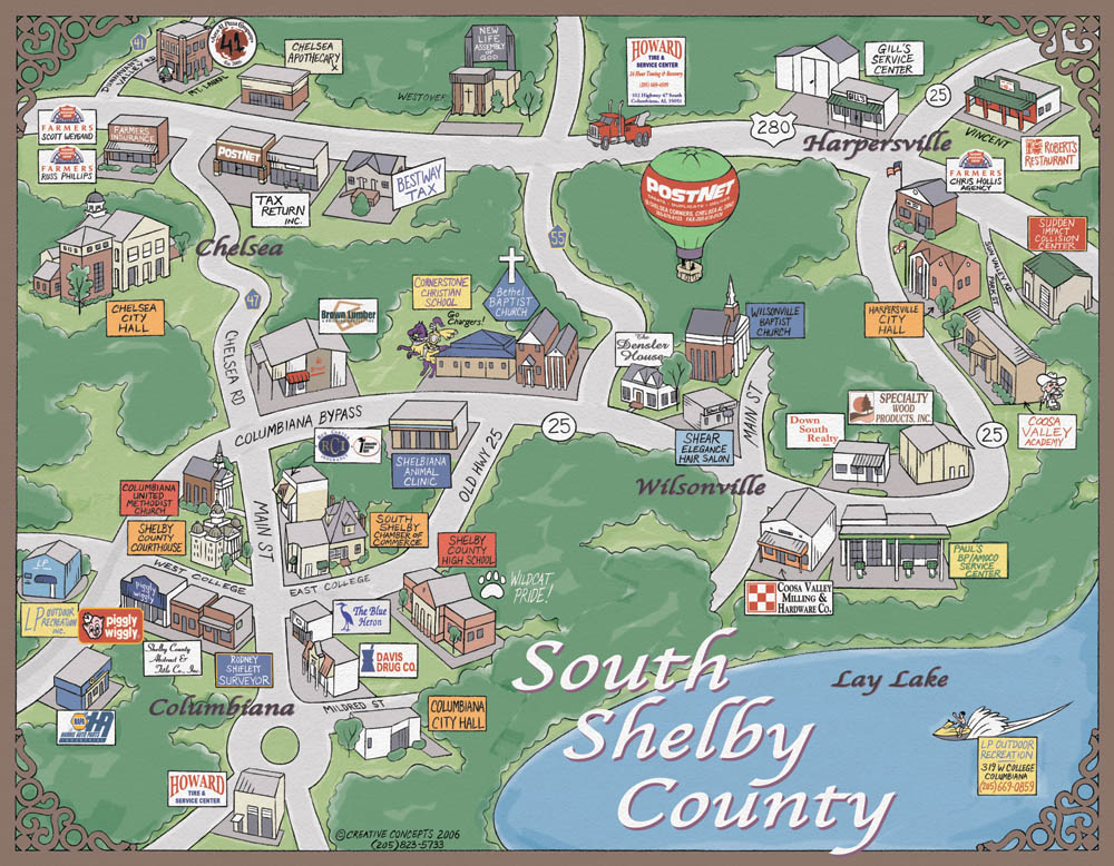
South Shelby County, AL
Here's South Shelby County:

My orders on this one were, "No funny stuff." I guess these towns wanted a more serious tone or something. So, I avoided any overly silly details, like I had in the Monteagle map. I also used a less cartoony palette, with more tasteful colors.
I needed to turn this one out quickly, so I skipped some of the hard stuff (art vs. commerce, you know). This time, I didn't do: The horizon and sky, the curve of the earth, the shadows, the oval signs, the snazzy gradients and fonts on the signs, the hand-lettered town names, the complicated trees, or the extra detail I was putting into each building. But I did use a more painterly technique on the greenery and the lake, and I added a texture that sort of makes it look like watercolor paper. And I put some fancy doodads in the corners.
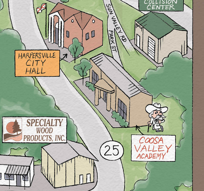
Here's the Coosa Valley Academy Rebel:
 It's weird to have a plantation owner as a mascot. Maybe they didn't get the news about our having lost the War Between the States.
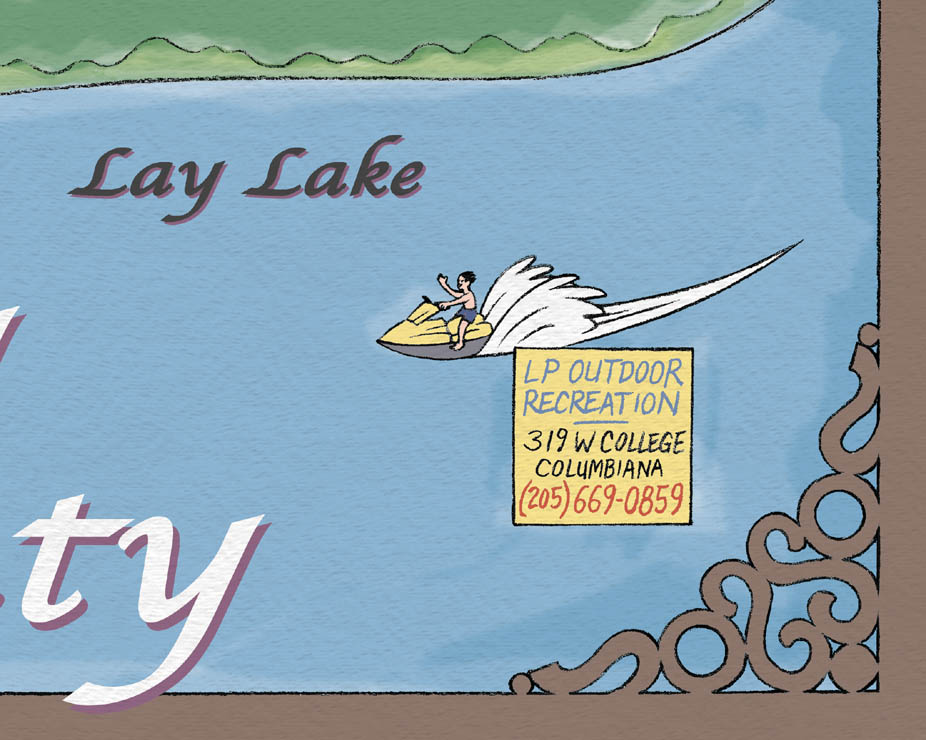
Meanwhile, this guy's on a Sea-Doo: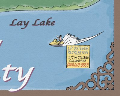
South Shelby Line Drawing
Here's the line work for my map of South Shelby County, Alabama. The town names aren't on there yet, but that's Chelsea in the upper left, Harpersville in the upper right, Wilsonville below that, and Columbiana in the lower left. In the lower right is Lay Lake. Hopefully it won't take me too long to finish the color version.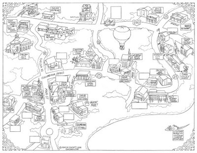
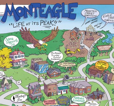
Monteagle, TN
At last, I'm done! Here's my map of Monteagle, Tennessee (also including Sewanee and Tracy City):
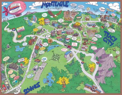 My big innovation is the curved earth. I thought that would be fun, to make it feel like you're looking down on this cute, little, cartoon planet. I think this is the first time anyone's shown the curvature of the horizon on a University Graphics / Creative Concepts map.
I colored it on the computer, but I tried to inject some painterly texture into the grass, trees, and sky. It's pretty subtle, and I really won't know how it came out until I see the printed version. You can kind of see it here, but I was afraid to go overboard, not knowing how it would look when printed.
The colors look a little faded here. I hope it comes out a bit richer, on paper.
This map took me a really long time to finish, because I went on a week's vacation after I got started, and I also had to stop to do the updates to the old Grambling and Samford maps.
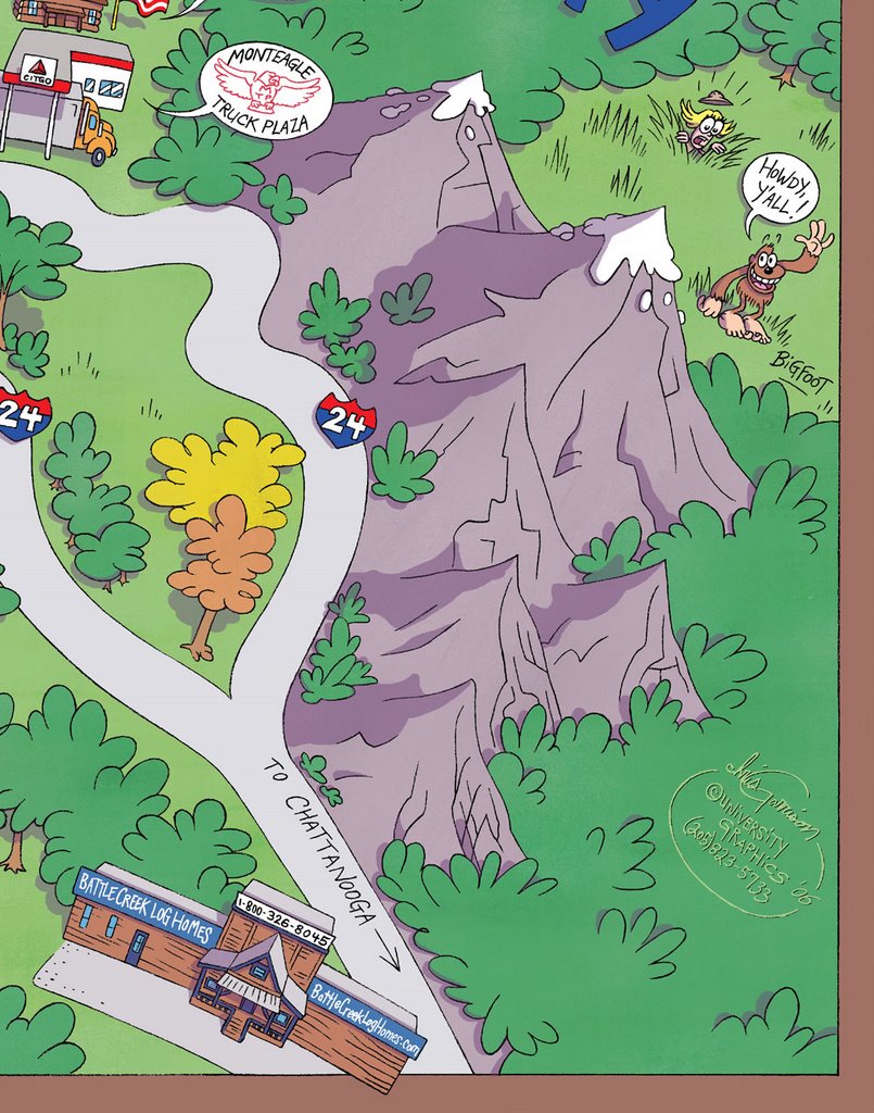
I wanted this to be one of those maps you can pore over for a long time, and I always think that's helped by throwing a few people into the world. I put some silly passengers in the blimp, here, and a hermit in a cave. The area's full of caves, and I know the folks at the Monteagle City Hall / Chamber of Commerce wanted me to show some of the waterfalls they're famous for.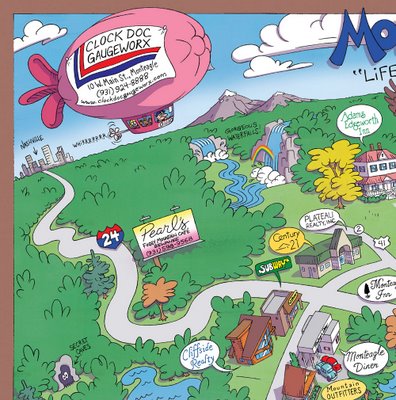 Here's the Monteagle eagle. And their City Hall / Chamber of Commerce, with its convenient a drive-thru:
I put in the Grim Reaper, coming to make a purchase from Marugg, this old scythe company in Tracy City. The fruit bowl is some kind of feature in Grundy Forest. I don't know what it is.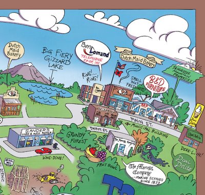 Bigfoot, of course:
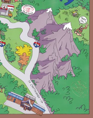 More silliness with the fisherman and the bear:
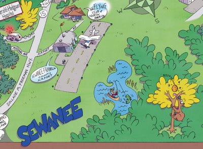 I like to think that the ambulance on its way to the hospital (above) is carrying the driver of the wrecked car, being pulled behind the tow truck (below). Hey, maybe that's why the Reaper needs a new scythe!
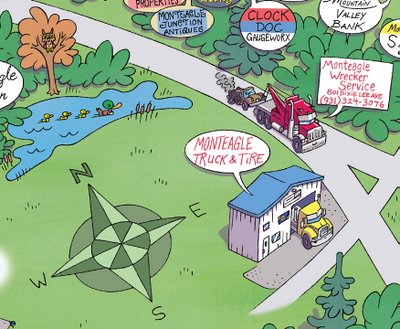


 I inked it digitally in Manga Studio. These colored lines will make it easier for me to do self-lined roads and such.


 I'll put a big Jeff State logo in the upper left. The box on the right will be the Campus Index. The large part of the map will be labeled "Jefferson Campus." The sections across the bottom will be labeled, from left to right, "St. Clair Moody Site," "St. Clair Pell City Site," "Chilton-Clanton Site," and "Shelby-Hoover Campus." Now down to the business of color.


 It's weird to have a plantation owner as a mascot. Maybe they didn't get the news about our having lost the War Between the States.